Friday, June 21, 2019

Appalacian Trail: Albert Mountain to Fontana Dam...


"Beans, here."

And this is today's (virtual) hiking goal.


We stopped yesterday a bit shy of half-way through North Carolina because...who knew (even virtually) how long a hike really was to Fontana Dam?

Checked out Evan's (E-Wolf) hike-thru last night...and got to meet some other amazing thru-hikers. Headstand, Luke, Yelp, Bob Gnarley, Gus, and Happy Feet.

You can, too...

E-Wolf's Hike-Thru

https://youtu.be/lgdvgndSHFE

Evan has a bit different approach to his hike-thru, as he utilizes off trail motels and the hot shower these provide...as well as restaurant food...a lot.  No judgement here. Just a more comfortable approach.

As with Dixie's hike-thru, his vlog of his trek accentuates just how much RAIN one actually encounters through most of the mountains. 

Today we begin the day with a packet of oatmeal...with some cinnamon and chopped dried apples mixed in.  Clean our pot and note that today there is no rain and the sun is shining brightly.

(...it seems our Real Weather here has imitated AT weather...as it has literally been monsoon rains off and on all week...it is nice to see the sun again...)

I had to put together my own oatmeal (ziplock baggie) oatmeal packets as I detest instant oats and prefer old fashion. I add cinnamon and sugar to the dry ingredients. When I restock want to add raisins and pecans to these as well.

It takes a bit longer for breakfast...but doesn't taste like wallpaper paste...so there is that.


A new exciting finding for me is the distance calculator for both shelters and landmarks on the AT.

https://www.atdist.com/atdist

Very helpful.

Long Branch Shelter (where we stopped) and Fontana Dam (our destination for tonight) is 64.5 miles. A lot of it up and down mountains...so we had best get started.

(...this distance would normally take at least 3 days hard hiking...but hey...this is virtual...)

Our first spot on the map Glassmine Gap.

This part of the AT has been called The Trail of Enchantment. There are many rocky creekbeds, running waters and waterfalls.


From tiny riffs...to Glassmine Falls


Glassmine Falls: See and hear it yourselves...

https://youtu.be/S-ZfWYxe7OI

Glassmine Gap was named for an old Mica Mine near the base of the Falls. During the time the miners referred to mica as glass.

Mica


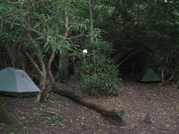
7 miles later we reach Rock Gap


The Rock Gap Shelter


and The Wasilik Poplar


The base is 26 feet in circumference.

So large that it takes many people with arms outstretched to encircle it.

The incredible trees on the AT are a pleasant surprise and I may end up painting a series of them. I LOVE interesting trees.

The enormous Poplar is the second largest Poplar in the Nation.

While traveling through Connecticut one year, my late husband observed wryly that

"If you spit on the ground here...some fool arrives with a sign and gives it a name...calling it "so and so" pond."

It's True.

Seems it is much the same with North Carolina and her "Gaps".

We won't be exploring all of them on our hike-thru or we will NEVER reach Fontana Dam and the Tennessee Line.

We will explore some- and if you want to find out more about the other...I will be naming them as we hike along.

So we will pass through Wallace Gap, Winding Stair Gap, Swing Lick Gap and Panther Gap...until we reach Silar Bald Shelter.


At this point we have hiked 12 miles and up and down several mountains. The AT is like the children's story of the little bear who climbed the mountain

"And what do you think he saw?"

That's right...ANOTHER MOUNTAIN!

And so it is onward we go...through Wayah Gap, Across USFS 69, Wine Spring and Wayah Bald to Licklog Gap.


 Wayah Bald Lookout


Arriving at Licklog is like a tiny oasis in the midst of The Trail.

 Licklog Mill Store, right in the middle of nowhere.


A chance to breathe, take the load off and resupply.

But mostly breathe.


The view of Licklog Ridge.


 Licklog Creek and Falls.


Licklog Shelter.

After a rest, resupply and snack we move on...

Past Burnington Gap, Cold Spring Shelter, Copper Ridge, Rocky Bald, Tellico Gap until we reach Wesser Bald and the Observation Tower.

Wesser Bald

(view from tower)


Looking over Tellico Gap.

Complete 360 View from the Wesser Bald Observation Tower

https://youtu.be/TVIBd5x0QFs

The Wesser Creek Trail


 and  Wesser Bald Shelter


then resume our hike...

Past the Natahala River


Past Wright Gap, Grassy Gap, and Swim Bald to the

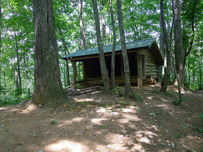
Sassafras Shelter at Sassafras Gap

then onward

Over Cheoah Bald (Mountain), Locust Cove Gap, Simp Gap, Stecoah Gap, and Sweetwater Gap...until we reach Brown Fork Gap and Shelter.

Relocation of part of the Brown Fork AT back in 2017 after a washout.

(...an aside..having actually hiked in the red clay these guys are digging through...all I can think is how very slippery this would be when it is wet...)


Brown Fork Shelter

(...to see what we have left to go...Highlander's hike from Brown Fork Shelter to Fontana Dam...)

https://youtu.be/PfD_KZxIDRA

And this gives me serious hope...only 12 more miles to Fontana Dam!

We CAN do this...

Across Hogback Gap, Cody Gap, and Yellowcreek Gap...to Cable Gap.


Hogsback Gap


Cable Gap Shelter

and following Pee-Wee from Cable Shelter to Fontana Dam (5.5 miles)

https://youtu.be/lhsaM-bt5_8

Black Gum Gap, Walker Gap, Yellow Creek Trail, and we can see Fontana Dam through the trees...


And the sights and sounds

https://youtu.be/GDmcE5Mgk6g

and Fontana Dam Shelter
(aka The Fontana Hilton)

A Hike-Thru with Statue and Spitfire and friends.

https://youtu.be/nUDvJtTxsrE

Going to take a couple of Zero Days over the weekend, and we will cross over into Tennessee and The Great Smokey Mountains on Monday!

Hope you are enjoying this Virtual Adventure.

love,
Beans


Thursday, June 20, 2019

Appalachian Trail: Bly Gap to Albert Mountain (North Carolina)


The Live Oak greeting you at Bly Gap...soon to cross over to NC.

Day Two of our virtual thru-hike.

I've decided to add a bit more realism to my hike by buying and preparing/eating some of the "trail foods" that are suggested for the AT. I'll share my experiences with those along the way.

This stretch is 88 miles and would normally take around 4 to 5 days.

Through the magic of virtual travel we will make it much sooner!

Come along...

The gnarled Oak tree above will be the first sign that you have reached North Carolina.

Called The Bly Oak, I fell in love instantly and MUST paint this landmark.
In Real Time, I would have spent an inordinate amount of time photographing the thing.


Although it looks like such a short jaunt on the map...it is actually through some of the highest mountains in North Carolina...and at 20+ miles a day...still takes over 4 days to hike.

The first stop this morning is High Top.

The view from Hightop.

4037 feet in 1/2 a mile.

After a short descent- the trail climbs again to

Courthouse Bald Mountain. 4645 feet in height...and we have traveled only another mile and a half.

I am beginning to see why this leg of the journey takes days!

When the AT descends it drops you into Sassafras Gap.
Sassafras Gap

The Sassafras Gap Shelter

The View from Sassafras Gap

The trail resumes its climb, and in 3 more miles you will see Muskrat Creek

Where you can take a short side jaunt down the Kimsey Trail and the creek is a wonderful place to replenish your water.  Just remember to use your water purification tablets!

A Thru-Hike would be a horrible place to get sick.

The Muskrat Creek Shelter

The BEST trail signage yet...


Vlog from Bly Gap/Dick's Creek to Muskrat Shelter  by PT

https://youtu.be/En-4IKVlpDE

Close-up of Muskrat Creek Shelter

https://youtu.be/RdqwOTWD2GA

So far we have met Dixie and PT on the AT (above vlog), and I have been thinking a lot about this whole "trail name" thing...which seems important...and everyone takes one.

"Needs-More-Coffee" seems a mouthful.

"MC" is kind of a rip off of PT.

" Mo'Coffee" was too gangsta for me.

And Coffee-Beans...though appropriate I have shortened to "Beans"

(...also encompasses a few of my favorite things...human beans...coffee beans...cacao beans from which chocolate is made....jelly beans...pinto beans...) 

Yeah...shortening my trail name to "Beans"

lol

So, that's sorted.

Leaving Muskrat Creek Shelter we now take the 8 mile uphill (up mountain?) hike to Standing Indian Shelter.

The Hike from Deep Gap to Standing Indian

https://youtu.be/ciT0dFcqm10

And I love the identification of various flora in this vlog from a dayhike.

The view from the top of Standing Indian Mountain.


The Cherokee Name for this mountain is Yunwitsule-nunyi,...translated to "Where the man stood" commemorating the tale of a Cherokee Warrior sent to protect this mountain.

It is 5500 feet high.

Hike to Standing Indian with "Redbeard" (Redbeard was hiking with "Toast" who hurt his leg and knee and is off the trail for awhile.)


https://youtu.be/49z1-D2sF_k

Standing Indian Shelter


The Shelter sleeps 8 and has numerous camping spots around its perimeter...also a privy.

As the trail continues down the mountain we will see

Beech Gap


 I am loving all the interesting trees along the AT!!!

Through Coleman Gap to Carter Gap

And the Carter Gap Shelter


Which also has numerous areas for primitive tent camping.


The AT continues through Betty Creek Gap and Mooney Gap and follows the Ridgepole Mountain.


View of Ridgepole from Betty Creek Gap

Although there is no shelter at Betty Creek...there are several cleared campsites.

 Hiking a bit more brings us to Mooney Gap.

And USFS Road 83.

(...as an aside...Mooney Gap is said to receive over 93 inches of rain every year...this may explain why most of the Georgia/ North Carolina trail hikes I have seen so far shows so many really rainy muddy slippery days...)

The trail now leads us to Albert Mountain

Rock Gap to Albert Mountain


As the terrain gets rockier and steeper...


.
And the view from the summit.

A Video from the Firetower on Albert Mountain

https://youtu.be/RjzP1odcs4E

Standing Indian to Albert Mountain Hike 

https://youtu.be/YKtVWkNNB_M


A short hike later brings us to where we will conclude today's journey at
Big Spring Shelter.


Big Spring Shelter

https://youtu.be/M8WQXt6CuA4

(...sadly this shelter has been torn down...forcing us to trek on to the newly built 
Long Branch Shelter two miles further up the trail...)


Long Branch Shelter


The newest shelter on the trail in North Carolina...and well worth 2 extra miles.

17 miles from Franklin North Carolina on the Trail...this is sturdy and built to last.

Going to try the first of my trail food today with a trail-pack of Fettuccine Alfredo.

It is a just add to boiling water...let sit...and stir process. Can't get much easier than that.

250  calories

18 grams of protein.

Also Iron and Calcium.

The package weighs 4.4 ounces...a consideration when you are (actually) backpacking in food.

The blurb on the front boasts a beautiful bowl of Fettuccine Alfredo and the words

"Creamy Cheese Sauce and Pasta"


We'll see...and finish this blog after it is made.

On up the trail...

love
"Beans"


Okay....made the pasta.


Added cracked pepper...because...yeah...I pepper everything.

Easy one small pot and boiling water meal.

Quicky made...maybe 5 minutes. Sauce thickens more as it cools.

Pasta is pretty much what you expect from instant...thinner..shorter.

Sauce is rich...tastes great.

Probably better eaten with a spoon.

When cold congeals, and remainders leave the cooking pot in one solid mass.

Would make a great hot meal with very little prep...quick clean up...after a day hiking the trail!